You may wonder what mangroves in Kenya actually do for coastal people. They shield shorelines, support fisheries and now earn carbon income for villages, though at least 40 percent have been lost over four decades.
This guide sits within the wider look at the coastal ecosystems of Kenya and Mozambique.
| Item | Value |
|---|---|
| Estimated mangrove area in Kenya | 60,000 hectares |
| Share of that area in Lamu and surrounding islands | 70 percent |
| Mangroves lost over the last four decades | At least 40 percent |
| Estimated emissions from mangrove loss and degradation | 24 megatonnes of CO2 equivalent per year |
| Mikoko Pamoja area after expansion (reported September 2025) | 300 hectares |
These figures come from the Ocean Panel project page and a report in The Star. Estimates and project figures can change, so check the sources before you rely on them.
Where mangroves grow in Kenya
The area of mangroves in Kenya is estimated at 60,000 hectares, and 70 percent of it lies in Lamu and surrounding islands, according to the Ocean Panel. The same page describes these forests as providing goods and services of ecological, economic and environmental value.
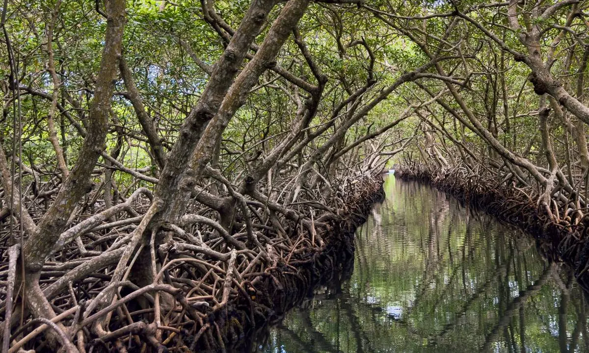
Farther south, Gazi village sits 50 kilometers south of Mombasa, beside a dense patch of mangroves along Gazi Bay, as Science News reported in 2022. Trees there can grow up to 27 meters tall, and their looping roots act like stilts that keep trunks and branches above the waterline at low tide.
What do mangroves do for coastal communities?
The Ocean Panel describes mangroves as ecosystems that give people a wide range of benefits, including exceptional carbon sequestration and protection against climate change impacts. The main ecosystem services named in the sources are:
- Shoreline protection: the thickets of roots prevent soil erosion and buffer coastlines against tropical storms, according to Science News.
- Habitat and fisheries: shorebirds and fish live among the roots and branches, and a local tour guide told the same outlet that mangroves safeguard the marine ecosystem on which fisheries depend.
- Carbon storage: mangrove roots support an ecosystem that stores four times as much carbon as inland forests, per the same article.
- Income: carbon-credit revenue and ecotourism earnings are split between salaries, project costs and village improvements to health care, sanitation and schools.
The carbon figure is explained by slow decay: saltwater slows the decomposition of organic matter, so carbon stays locked in the mud.
Wood harvesting and why the forests declined
Under British rule, which stretched from the 1890s to 1963, the colonial government issued licenses to private companies to export mangrove wood, according to Science News. This happened without community involvement, which led to poaching of trees.
After independence, mangroves stayed an important source of timber and fuel for industrial processes, which the article calls main drivers of extensive destruction. The Ocean Panel lists three factors behind present-day loss and degradation:
- Overharvesting of mangrove wood products.
- Conversion pressure.
- Pollution effects.
The same page says at least 40 percent of Kenya’s mangroves were lost during the last four decades. It estimates emissions from this loss and degradation at 24 megatonnes of CO2 equivalent per year, three times the emissions from the transport sector.
Mikoko Pamoja: Gazi Bay’s carbon-credit model
The Kenya Marine and Fisheries Research Institute launched and runs Mikoko Pamoja, described by the Ocean Panel as the world’s first community-led project to restore and protect mangrove forests through the sale of carbon credits. Science News reports it launched in 2013 and earned the United Nations’ Equator Prize in 2017.
In the words of a KMFRI chief scientist quoted by The Star in September 2025, each credit equals one tonne of avoided, reduced or removed carbon, and all carbon credits are owned by the community. The Ocean Panel page reports these community results:
- 73 percent of local people rely on water points provided by the project.
- 600 textbooks were provided for local schools.
- Water was made freely available to over 1,000 students in two local schools.
- In 2018, 1,473 people visited the project.
- In 2018, 148 employment opportunities were created for monitoring activities.
The same page credits strong community relationships and local engagement for the project’s success, with grassroots organisations central to running it. One such group, Gazi Ecotourism Ventures, is described by Science News as dedicated to empowering women and their community through mangrove conservation.
Vanga Blue Forest and the expansion figures
Vanga Blue Forest lies in the transboundary mangroves of Kenya and Tanzania. The Ocean Panel says it was set to offset 5,500 tonnes of carbon dioxide equivalent per year over a 20-year contracting period starting in 2019.
The Star reports that the project protects 460 hectares of mangroves and supports the livelihoods of nearly 9,000 people in three villages: Vanga, Jimbo and Kiwegu. Its 26 September 2025 article also gives before-and-after figures for both projects, presented by a KMFRI chief scientist:
| Measure | Mikoko Pamoja (before, after) | Vanga Blue Forest (before, after) |
|---|---|---|
| Area | 117.4 hectares, then 300 hectares | 460 hectares, then 800 hectares |
| Carbon removed, as reported | 2,500 tonnes, then 7,000 tonnes | 5,500 tonnes, then 8,700 tonnes |
| Annual revenue | $16,000, then $44,800 | $47,000, then $81,000 |
| Community development funds | $3,000, then $13,800 | $14,000, then $28,000 |
The table’s figures come from The Star’s 26 September 2025 report of one scientist’s presentation, so treat them as reported rather than audited and check the source before you rely on them. The same report says Kenya plans to reduce its greenhouse gas emissions by 35 percent by 2035 and has included ocean climate action in its Nationally Determined Contributions.
How does this connect to Mozambique and the wider region?
Science News reported in 2022 that the Mikoko Pamoja approach was being copied farther south on Kenya’s coastline and in Mozambique and Madagascar. That makes the Kenyan case a useful reference point for neighbouring coasts.
You can read how the model compares on the neighbouring coast in the guide to Mozambique mangroves. Readers comparing East African coastal areas can also look at the Bazaruto Archipelago for a broader coastal picture.
Frequently asked questions
How much mangrove does Kenya have?
Show answer
A KMFRI chief scientist quoted by The Star in September 2025 gave the same 60,000-hectare figure.
What is Mikoko Pamoja?
Show answer
It is a community-led project in Gazi Bay that funds mangrove protection and restoration through the sale of carbon credits. As of the Ocean Panel’s description, it is the world’s first project of this kind, and it launched in 2013 according to Science News.
Why have Kenya’s mangroves declined?
Show answer
The Ocean Panel names overharvesting of wood products, conversion pressure and pollution. Science News adds that licensed wood exports under British rule and later demand for timber and fuel drove extensive destruction.
Who owns the carbon credits?
Show answer
A KMFRI chief scientist told The Star in September 2025 that all carbon credits are owned by the community.